
North Texas experienced a noticeably cooler start to Thursday, with temperatures ranging from the 40s to the 50s following the passage of a cold front through the region. Afternoon conditions are expected to see temperatures rise into the upper 70s, approximately 10 degrees above seasonal averages.
A second cold front is anticipated to push through later Thursday, subsequently bringing high temperatures down into the upper 60s by Friday.
Temperatures are forecast to continue declining heading into the weekend, as a developing weather system approaches the region on Saturday. Two distinct weather waves are expected to move through the area, with rain chances increasing to the west by Saturday afternoon, followed by widespread rainfall arriving overnight and extending into Sunday.
Saturday is also expected to bring breezy conditions, with wind gusts reaching between 20 and 25 mph.
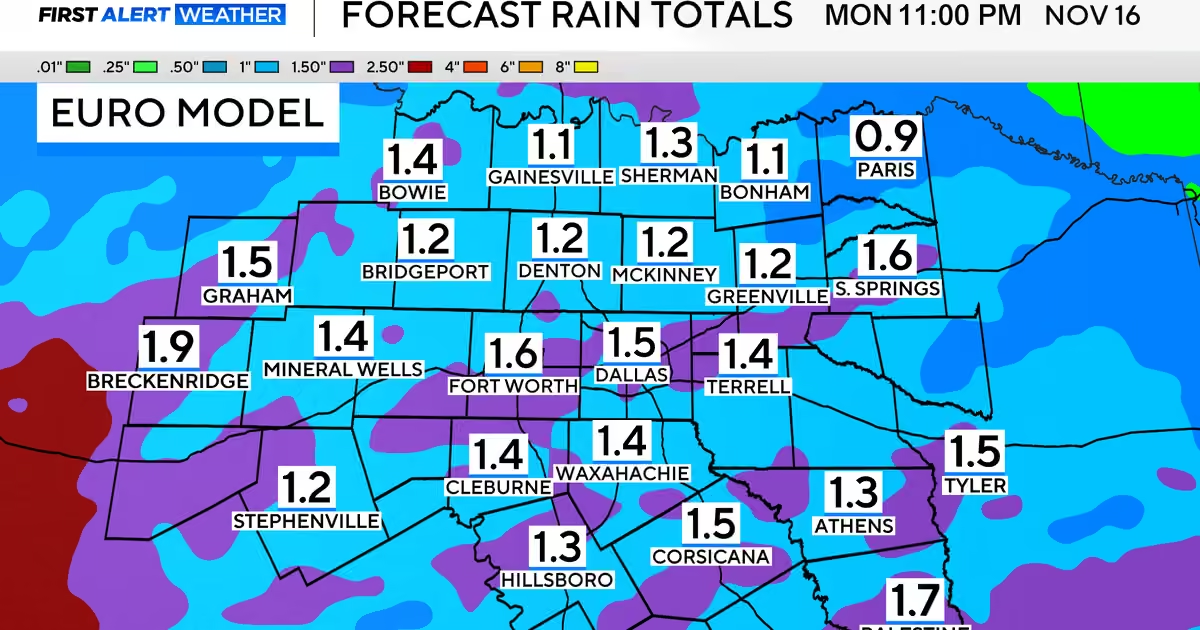
Current forecast models have yet to reach a consensus on the precise timing of when rainfall will exit the Dallas-Fort Worth area; however, precipitation is likely to persist into Sunday afternoon. Rainfall totals are projected to reach approximately one inch, which would provide considerable relief given the ongoing drought conditions affecting North Texas.
Sunday is expected to feel significantly cooler, with high temperatures settling into the 50s. This cooling trend is set to continue into the early part of the following week, with temperatures remaining below seasonal averages.