A Flood Watch and Severe Thunderstorm Watch cover most of the Chicago area through the overnight hours from Sunday into Monday, including portions of Northwest Indiana.
Additional rounds of potentially severe storms began sweeping into the region after 8 p.m., unleashing more heavy rain, powerful winds and lightning. The storms are expected to continue overnight, with widespread flooding posing a serious threat.
A Flood Watch is in effect for Boone, La Salle, Lee, Livingston, Ogle, Winnebago, Cook, DeKalb, DuPage, Will, Grundy Kane, Kankakee, Kendall, Lake and McHenry counties in Illinois, along with Benton, Jasper, Lake, Newton and Porter counties in Indiana, lasting until 7 a.m.
A Severe Thunderstorm Watch covers Cook, Lake, La Salle, Kane, Kankakee, Grundy, Will, De Kalb, DuPage, McHenry and Kendall counties in Illinois and Lake, Newton, Jasper and Porter counties in Indiana until 4 a.m.
A Flash Flood Watch has been issued from 9 p.m. Sunday until 7 a.m. Monday for most of Northeast Illinois and Northwest Indiana.
As of 9:10 p.m., ComEd reported power outages impacting roughly 9,400 customers in Illinois, while Nipsco reported outages affecting just over 9,000 customers in Indiana.
Ground stops were issued at both O’Hare and Midway international airports because of the thunderstorms on Sunday, and major delays were reported at O’Hare.
The Chicago White Sox game against the Cleveland Guardians was delayed for more than two hours.
More potentially severe storms are expected in Chicago on Monday and Tuesday.
Afternoon downpours cause flooding
The first wave of storms during the midday hours Sunday dumped 1 to 2 inches of rainfall on the area.
Severe storms in Wisconsin pushed east at 30 mph during the morning, with the entire line drifting southeastward. By early afternoon, they had reached the Chicago area.
At 2 p.m., rain poured from dark skies over the Loop as lightning flashed and thunder rumbled. Rain finally tapered off around 3 p.m.
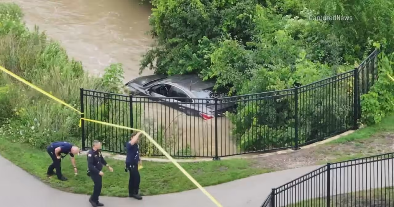
In far north suburban Mundelein, firefighters pulled two people from a car at Midland and Courtland just before 1 p.m. They had become trapped in a drainage culvert beneath a pedestrian overpass by floodwater.
The water churned rapidly around the car, climbing above the license plate.
Neither person was hospitalized, though one firefighter was transported to a hospital as a precaution after the rescue.
In southwest suburban Bridgeview, Southfield Drive off Harlem Avenue was so submerged that the only visible marker of the street was a fire hydrant poking above the waterline. Hours later, some streets remained flooded.
“No do not try it, do not try to go down that path,” warned resident Monica Castigione. “Just turn around and find another spot.”
She saw multiple drivers become stuck.
“We were trying to go to McDonald’s, but it was really like, cars were on the side of the road and they were waiting for AAA because they tried to go to them on the road and you can’t you cannot get through,” she said.
But one driver’s obstacle became another neighbor’s attraction. Some children were seen happily wading into the water after earlier swimming plans had been washed out by the rain.
In the southwest suburb of Hometown, 88th Street was closed between Kenton and Cicero avenues because of roadway flooding.
More from CBS News
- Strong storms may bring heavy rain, high winds to North Central Georgia
- Storms weaken Saturday evening in Philadelphia region
- Humidity levels drop in NYC area on Sunday before creeping up again
- Storms, heavy rainfall possible in Southeast Michigan on Sunday and Monday
- Colorado heat continues before cooler, wetter weather arrives
In:
- Severe Thunderstorm Watch
- Severe Weather
- Flooding