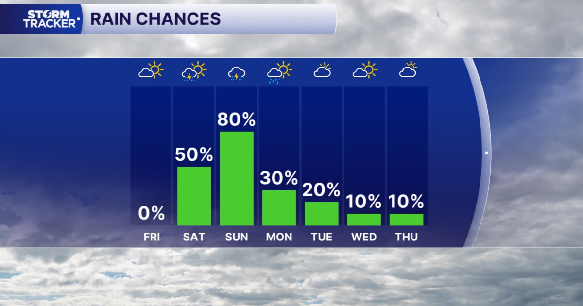
We are keeping the warm, dry, and sunny streak alive for another day, and conditions outside are absolutely lovely. Plan to soak in the clear skies for one more day tomorrow, because significant changes are heading our way just in time for the weekend. We continue to track Hurricane Isaias, which still promises to deliver rain and breezy conditions over the weekend. At this moment, the heaviest rainfall looks to stay just west of Lexington toward western KY, but showers remain a real possibility around game time. Expect clouds to build late Friday afternoon, with rain showers likely rolling in on Saturday. While the precise timing remains uncertain, the wet weather will likely linger through Saturday night and into Sunday. We do not anticipate strong thunderstorms, though the system could bring some gusty winds.
As the low-pressure system moves past us late Sunday, the skies will clear, setting up a much calmer, quieter weather pattern for next week. You can expect a brief cool-down over the weekend, but temperatures will rebound nicely into the 70s and low 80s as the new week gets underway.