
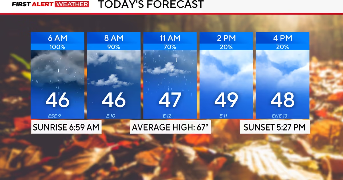
Sunday has been designated a First Alert Weather Day due to the anticipated disruptive rainfall affecting the region. Precipitation will be at its most intense during the morning hours before gradually tapering off into the afternoon.
While a few rumbles of thunder are possible, no severe weather conditions or flooding are anticipated at this time. Residents with morning engagements are strongly advised to exercise caution on the roads, as wet surface conditions will be prevalent throughout the area.
Drizzle and light showers are expected to persist through the remainder of Sunday and continue into the overnight hours, maintaining unsettled conditions across the region.
The persistent cloud cover combined with ongoing rainfall will drive temperatures significantly below seasonal averages, with afternoon highs unlikely to surpass the mid-40s. Sunday is projected to be the coldest day North Texas has experienced since mid-March. Easterly winds, with gusts reaching up to 25 mph, will further reduce the apparent temperature, making conditions feel considerably colder than indicated.
A gradual warming trend is forecast to develop heading into the workweek. Monday morning will bring drizzle and patchy fog, with temperatures remaining in the 40s beneath overcast skies. Conditions are expected to improve by the afternoon, with sunshine returning and highs climbing into the upper 50s.
A strengthening ridge of high pressure is anticipated to develop on Tuesday, promoting warmer temperatures and allowing increased sunshine to break through the cloud cover throughout the day.
The next weather disturbance is currently forecast to move through North Texas on Thursday, presenting another opportunity for isolated storm activity. Additional unsettled weather, along with the next cold front, is expected to arrive the following weekend.